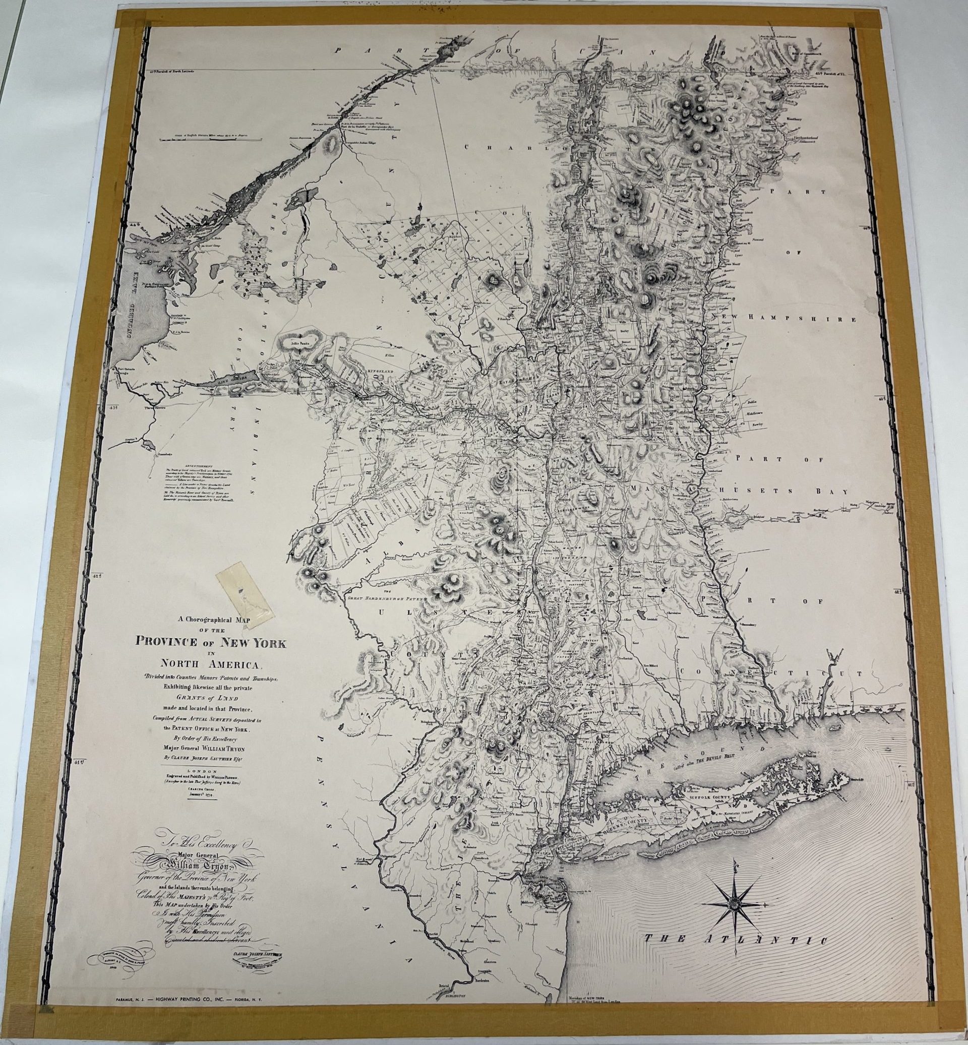
The text from the map in the picture frame above reads;
A chorographical Map of the province of New York in North America Divided into counties, manors, patents and townships. Exibiting likewise all the private grants of land made and located in that province. Compiled from actual surveys deposited in the patent office at New York. By order of his Excellency Major General William Tryon By Claude Joseph Sauthier.
This 1779 map was compiled from land surveys by Claude Joseph Sauthier, a Frenchman with training in illustration. Between 1768 and 1771, Sauthier was commissioned by William Tryon, governor of North Carolina, to map North Carolina’s militarily important towns.
Tryon became the governor of New York in 1771, taking Sauthier with him. Sauthier worked to map New York from 1771 to 1777, giving him the knowledge necessary to create this map.
The publication of this map was highly relevant to the military activities of 1779. It was in this year that British commander-in-chief Sir Henry Clinton attempted a second campaign into the Hudson Valley. One of Clinton’s main focuses in this campaign was to fortify the ferry at Stony Point, where a battle took place on July 16 and the British were forced to retreat from their fortifications there. Other notable events in the campaign include the Philipsburg Proclamation and the Battle of Paulus Hook. The 1779 campaign ended in Clinton retreating back to Manhattan.
It is maps like this one that may have helped Clinton in forming his campaign plans, or they may have helped the people in England understand what might be happening on the war front across the ocean in the American colonies.
Today, this map can help us see the world how people saw it two hundred years ago. Whereas our maps today are filled with roads and highways, this map focuses on waterways and the terrain. Waterways were the most efficient form of transportation, and the terrain was much more of an obstacle for travel than it is today.