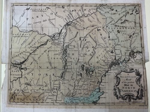
This map of New England from 1757. On the bottom left you can see the beginnings of “Skoheri” Creek. This map was published in an English magazine called The Universal Magazine of Knowledge and Pleasure which published works on the arts and sciences.
The purpose of this map was to show the theater of war during the Seven Years’ War as well as to show colonists which land was claimed by the French or the British. This map was also meant to show where Native Americans were at the time as they were key players in the war.