A History of the Town of Cobleskill
 Submitted by Ted Shuart
Town Historian
In 1751 Jacob Borst and partners acquired 4,800 acres of land in a small valley which straddled a creek called the Cobus Kil, about six miles west of the Schoharie Valley. The creek was named for early settler Jacobus Kobel. His first name was pronounced “Yah’ cobus” or Yah cob’ us” depending upon which German dialect one was speaking. “Cobus” was the common nickname for anyone named Jacobus at that time. “Kil” was an old Dutch name for a stream.
The laws for acquiring land in eighteenth century Colonial New York were very strict. If the Iroquois were willing to sell any land the Royal Governor had to give his consent, a survey had to be done with the Indians along to approve the boundaries, a deed needed to be signed by all parties (usually with some costly ceremony), then everything had to go to England for approval. The process normally took two years. Many early land grants were later considered extravagant (often more property granted than what the Royal Family owned in England) so by 1750 the British authorities had limited the size of the land grants to about 6,000 acres. Officials often took as much as a fourth of that as a government share. With an eye towards limiting the size of personal estates the law stated that no individual should apply for more than 2,000 acres unless he had partners. The system was easily manipulated and the partners were often quickly bought off at a minimum of cost.
Borst and his partners were all Germans; most, if not all, from the Schoharie Valley. Other Germans soon began purchasing land from them. Some came from the Hudson Valley, others were recent arrivals from Germany, up from Pennsylvania. The first two settlers on the Cobus Kil patent were from Ulster County. Pieter Shafer and his cousin Johannes Shafer shared 600 acres between them and may have been in the valley as early as 1749 although 1752 is traditionally given as the date of their settlement.
 The French and Indian War, fought in America from 1755 to 1760, apparently discouraged any further settlement at Cobus Kil for a while. A 1758 map shows the Shafers as the only inhabitants. Ten families moved to the patent during the 1760’s. Jacob Borst and his family, probably the first of the newcomers to arrive, settled in the vicinity of modern day Borst Noble Road. By 1770 the community stretched along roughly three miles of the Cobus Kil. On the eastern edge were the farm and mill belonging to Christian Brown, located about one mile east of the modern day village. Going west from there one would encounter Borst’s land, then the Shafer farm, then the Koenigs, Fersters (later site of the Bull’s Head Inn), Boucks, Lawyers (the college), and the Schells. The farms on the westernmost lots were inhabited by the Warners, who were recently arrived from Germany, the Zehs, and, possibly, the Frimires. A school was established in a crude, log building on the Shafer property and the children were instructed by a Schoolmaster named Plogger or Paughhoer. The settlers walked a few miles north, to the log church in the New Dorlach settlement, for religious services.
 When the American Revolution began in 1775 most of the Cobus Kill inhabitants gravitated towards the Patriots’ cause. A small company of militia, which became 4th Company, 15th Albany County Militia, was formed for the defense of the community.
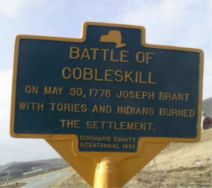
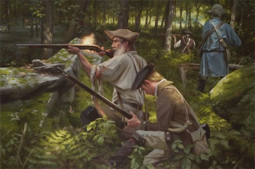
The frontier settlement was an easy target for the enemy and Cobus Kil became the first Schoharie community to be destroyed in the war. In the spring of 1778 Mohawk warrior Captain Joseph Brant kicked off a season of terror in upstate New York with a battle at Cobus Kil and the subsequent destruction of most of the property in the area.
On May 30, 1778 Captain William Patrick’s thirty four man company of the Continental Army’s 6th Massachusetts, and about twenty local militiamen, commanded by Captain Christian Brown, were lured into an ambush set by Brant near the Warner farm. Brant’s Tory force of Indians and Rangers nearly annihilated the soldiers and militiamen.
The local residents fled to the safety of the Schoharie and Hudson Valleys. Most were afraid to return. The following winter Fort Dubois, named for an officer of the New York State Continentals, was constructed on the ruins of the Pieter Shafer farm. It was lightly manned by militiamen, who performed guard duty in rotating shifts, for the next few years to protect the farmers who would only venture into their fields under an armed guard. During a raid three years later the enemy found the fort abandoned and burned it.
The community was greatly changed when the war ended. Some of the families left and did not return. Virtually every male member of the Ferster and Frimire families had been killed. One young man from the Zeh family was killed; his Tory brother fled to Canada. New settlers moved in. Many were military veterans who had received land or bounty money as compensation for years of service. Most of these men were New Englanders. English began to replace German as the predominant language in the area.
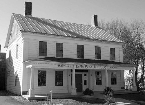
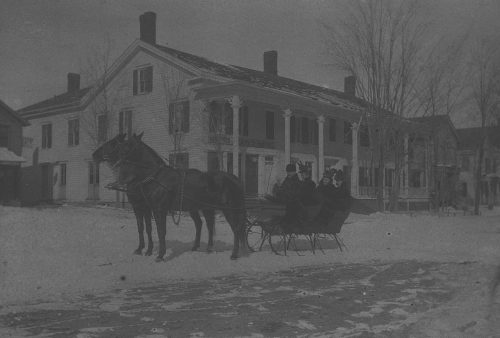
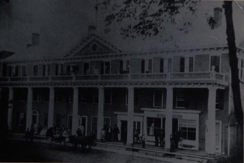
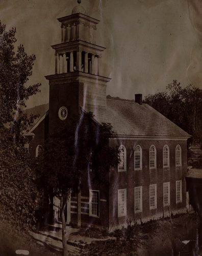
George Ferster built a log cabin on the ruins of his former home and operated it as a tavern. He sold it to Lambert Lawyer of Schoharie who added a frame addition and continued in the business. When the building burned in 1802 Lawyer had a new one constructed (the Bull’s Head Inn today). The Lutherans built a beautiful, brick church nearby in 1794. A store, and a few small businesses opened in the community. Physician Jabez Kromer moved there in 1793.
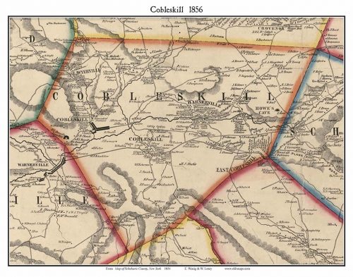
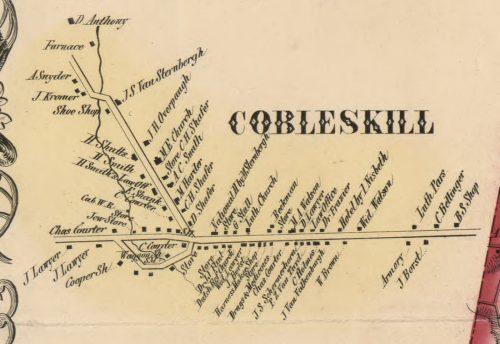
The town of Cobleskill was officially incorporated, as a part of Schoharie County, on March 17, 1797 in the long room of Lambert Lawyer’s Tavern. Officially the spelling of the town was now Cobelskill, while the name of the creek continued as Cobuskill.
Jacob France, a German from New Dorlach (now Dorloo) and son of well-known local patriot Sebastian France, purchased and settled upon land lying just south of Jacob Borst’s place. The little settlement developed into a hamlet after the Albany to Unadilla Turnpike was constructed through it in the first decade of the nineteenth century. It was known as France’s Corners until 1849 when it was renamed Cobleskill Center. The original Cobleskill Center became Warnerville that year since the community was no longer in the town of Cobleskill after the new town of Richmondville was formed from Cobleskill. The newly configured town of Cobleskill now featured France’s Corners right in its center so that community had its name changed accordingly. The place was renamed Mineral Springs in the 1860’s after a health spa opened there.
The district called Punch Kill by some and Schoharie Mountain by others lay between the Cobus Kill settlements and the village of Schoharie. At the beginning of the nineteenth century the Loonenburg Turnpike, connecting Loonenburg (modern day Athens, NY) to Cherry Valley, was built through the area. The Schoharie Road was improved and became a turnpike (the Schoharie Mountain Road today) at the same time and connected with the Loonenburg Pike at Punchkill. The Albany to Unadilla Turnpike was conveniently only a short distance to the west. The crossroads developed into a hamlet later called East Cobleskill. The Earl family owned and operated a brewery there for more than sixty years.
Joseph Berner waited for the war to end before marrying a Borst girl and settling along the creek to the south of Christian Brown’s mill. The Berners built and operated a mill and later a store there. Other mills and businesses followed. The Methodists built a Union Church there in the 1830’s. The hamlet, named Barnerville, competed for business with Cobleskill for some time.
A fulling mill (for finishing cloth) was established a short distance downstream from Berner’s Mill in 1816. A community in which John Brayman became the principal businessman developed around the mill. Saw mills, a grist mill, and cider mills operated there. The area became known as Brayman’s Mills and was later renamed Bramanville.
When Jacob Borst purchased the Cobus Kil patent in 1751 a similarly sized land patent immediately to the north was obtained by the Royal Governor’s secretary, a young man named Goldsbro Banyar. His land sat unsettled and unused for nearly forty years before he began selling it off. For many years the land grant was known to locals simply as “The Patent”. Soon so much of Banyar’s land was purchased by New Englanders that the area was unofficially named “New Boston”. Many of the new settlers had been officers in the Continental Army and were well connected, educated men. James Dana, John Reddington, and Moses Grosvenor were prominent among them. Master Builder Seth Wakeman built many New England style homes in the area, most of which still stand today. The community, which featured the first public library in Schoharie County, became a principal trading center for local farmers. In 1819 resident Congressman Thomas Lawyer, member of a German family in a famously Yankee community, had the place named Lawyersville after himself to the outrage of many of his neighbors. Ironically the place would become somewhat famous for the number of attorneys who lived there.
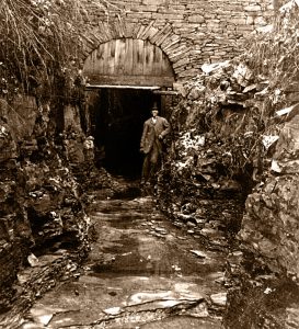
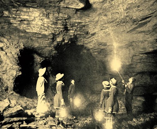
The story of the discovery of Howe Caverns is well known in Schoharie County. In the 1840’s Lester Howe opened his discovery to the public. It became an international sensation which equaled Niagara Falls as a New York State travel destination. When the Albany and Susquehanna Railroad ran their track through the town in 1864 a station was opened there and a small community grew around it. Howe eventually lost his property to local businessman Joseph Ramsey.
A half dozen stone quarries operated in the town of Cobleskill in the late nineteenth century. One of them, less than a mile west of Howe’s Cavern, alone employed 400 men. When tourism fell off late in the century Ramsey turned to rock quarrying and destroyed much of the lower cavern in the process. What remained of the cave was saved when the property was sold. Howe Caverns reopened to the public in 1929. Secret Caverns opened nearby that same year.
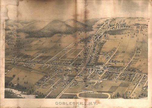
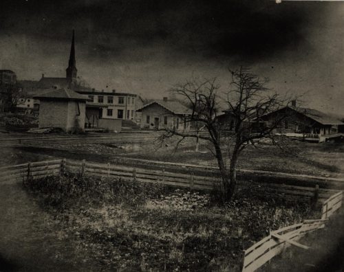
The Albany and Susquehanna Railroad officially opened its line through the town of Cobleskill in January, 1865. By then the hamlet of Cobleskill was a small, moderately prosperous, farming community with two taverns, three churches, a school house, several mills and a factory which produced farm equipment.
 The railroad brought so many new businesses and residents that the community was incorporated as a village in 1868. The population quadrupled in twenty years. Businesses were connected by telephone in the late 1870’s. By the 1880’s there were seven hotels, nine grocery stores, and three blacksmith shops operating. The Schoharie County fairgrounds was established in the village in 1876. Factories and mills developed along the railroad tracks while dealers in grain and hops opened offices on Main Street. So much pancake flour was produced in the village that Cobleskill became known as “the Pancake Flour Capital of the World”. Milk and cider was packed in ice and shipped to the cities. Beautiful new houses were constructed by successful businessmen. A power plant began supplying electricity in 1892.

When wheat production moved to the American mid-west and the hops industry declined the local farmers focused more on dairy production. In the early twentieth century the grain mills changed over to feed production or closed. Milk bottling plants replaced the mills. A textile and garment industry developed which would continue throughout most of the century. Harder Manufacturing stopped making farm machinery and began to produce refrigerators. Soft drinks were bottled locally. Numerous automobile dealerships opened. Main Street Cobleskill was a bustling place with a theatre, restaurants, department stores, and bars.
Cobleskill became an education center as well. At the beginning of the twentieth century a new, modern high school was constructed in the village. It featured indoor plumbing, a cafeteria, a library, auditorium, gymnasium, and a biology lab. Students took the train to school daily. In 1911 the state established a another school of higher education which would become SUNY Cobleskill.
The railroad made Cobleskill what it is today but at the expense of the other communities. The citizens of Barnerville lobbied for a station there also but to no avail. The Albany and Susquehanna officials simply did not want to build a bridge over the Cobleskill Creek. Over time most businesses in Barnerville and the other small hamlets relocated to the village of Cobleskill. For the most part today these communities exist primarily as a cluster of houses around a few surviving churches.

The village of Cobleskill remains the primary business center in Schoharie County.